
Innovations of the decade to come
/On Monday I posted what I think were the major advances in exploration and reservoir geoscience in the last decade. I wanted to follow up with a look at what might happen next.
As oil and gas become harder to find and develop safely, responsibly, and economically, our tools and data will only continue to improve. In particular, acceptable oil sands and shale gas recovery efficiency demand new ideas and new methods. I hope the next decade will see us making progress in some of these areas, some of them long-lived problems:
- Pre-stack interpretation is still, in my view, niche. Only a few interpreters have the patience and software tolerance to get into finding, loading, QC'ing, and analyzing gathers or even partial stacks. These data can show how amplitude varies with offset, the average distance between the source and the receiver (sometimes expressed as a reflection angle instead, with large angles being equivalent to long offsets). This can help with lithology and especially fluid prediction.
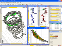 Image links to TIBCO's websiteMulti-variate analysis and prediction will be paramount as interpreters juggle more and richer data sets. As stacks, limited-angle stacks, inversions, volume attributes, and other volumes mont up, it will get harder to make decisions consistent with all the data. Sound probabilistic methods are needed, but also the ability to handle dozens of variables, each with its own error and uncertainties. GIS will play a big role here, as well as powerful analytics tools like TIBCO Spotfire 2011 (shown here).
 - GIS will get more integrated into our workflows. A lot of the silliness in PowerPoint is really quick GIS hacks. One upshot of this is that somewhat marginal data today, like gravity and magnetics, will get easier to integrate. It will also mean people make and show more beautiful maps, which can only be a good thing!
- Error and uncertainty are such monstrous problems that I am going to mention them again. Since every measurement we make in the subsurface is subject to error and uncertainty, we tend to ignore it (and sometimes abuse it!), handling it later with some sort of gross fudge factor. For example, instead of mapping different possible structures, or trying different velocity models, we simply say, 'Oh, the area could be wrong by 25%', so we arbitrarily run our volumetrics with that, and see if it 'looks right'. Maybe geoscientists think this is OK, but I don't think the VP of Exploration would agree with you!
- Effortlessly stepping across scale will be important if we are to unravel problems like fracturing, heterogeneity, stratigraphic prediction, and time-series phenomena (like production effects). The ability to see the whole picture, zoom in to see the details, and analyse these scales in different ways, is a challenge. We must bridge the Integration Gap.
- Intuitive and fast display manipulation tools. The mouse and keyboard are hopeless interpretation instruments and should be killed as soon as possible. Multi-touch, gestures, tablets: all the pieces are there. Some people are making progress already, for example check out this wonderful teaser from Wacom and open-source OpendTect software.
- Microsoft PowerPoint is a scourge on our productivity as scientists, in my opinion, at least as a documentation tool. Maybe, maybe, it has a rôle to play as a presentation tool. I see people drawing lines on maps, faking scale bars, stretching maps, showing weird-looking equations, and all sorts of other horrors. Try doing a presentation without slides one day; instead turn up with a handout, some maps, some rocks, and a smile, and I guarantee that people will be pleasantly surprised, thank you heartily, and tell everyone how cool your story was. Okay, enough ranting... I will post about this one day.
- Plotting will get easier. So much grief. So many wasted hours.
There should be some resemblance to the unsolved problems in exploration geoscience I posted a few weeks ago. Please let me know what I've missed!
PowerPoint is a trademark of Microsoft Corporation.Spotfire is a trademark of TIBCO. The screenshot of TIBOC Cpotfire 2011 is copyright of TIBCO and used here with permission, for which I am grateful. OpendTect is a trademark of dGB Earth Sciences. The YouTube clip is embedded and copyright of Wacom. I am not connected in any way to any of these companies.


 Except where noted, this content is licensed