Will this change anything?

Stubborn as it is, I often neglect to check the weather forecast before I go out in the morning. I live within walking distance to most things, and I can bear extreme cold for a few minutes (and even run if I have to). So for me, searching for a weather forecast the night before or the first thing won't actually change my morning routine. And that is to say nothing of the reliability of the forecasts!

Every one of us can pick and choose how much information to use in our daily lives. On one end of the spectrum is no information, where uncertainty and ambiguity reigns. On the other end is total information, which can be unwieldy and noisy. One way to hone in the appropriate balance is to ask the question, "will this change anything?"

When deciding whether to run a fancy diagnostic borehole tool, say, or to redo a structure map to include new well data, the wrong thing to ask is "what will this information do for me?", or even, "will this technology or method work?" Instead, we should be asking, "will this change anything?" 

Will adding (or excluding) this ingredient change the taste or outcome of my meal?

If the drilling engineer on your team is on the ball, cost conscious, and able to drill at 40 metres per hour, then LWD (logging-while-drilling) information may not actually allow you to steer the well on the fly. It's nice data to have after the fact, but it won't change how you drill the well. If your team's strategy is to drill relative time structural highs, then re-doing a velocity model for more accurate depth maps may be a waste of time. 

When we talk about how information might change our plans, or change our understanding, we are talking about it's value.  Asking, "will this change anything?" is really trying to pin down, "how much do I value this information?" The weather channel might be more valuable to you than it is to me, but how valuable is it? Will it change anything if you have to get on without it?

Ripples

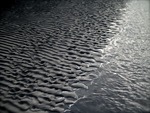
Yesterday I visited Sand Dollar Beach, near Lunenburg, with the kids. There's lots of room to run around: the beach has a 400 m wide foreshore, which means lots of shallow water at high tide (as in the Google Maps picture here). The low angle (less than half a degree) also sees the tide go in and out very quickly, allowing little time for reworking the delicate ripples. Their preservation is further helped by the fact that the waves along this sheltered coast are typically low-amplitude.


View Larger Map

At the edge of the just-visible stream cutting through the beach, the regular wave ripples, produced by oscillating currents, morph into more chaotic linguiod current ripples (right-hand side, mostly obscured by the stream). I can't say for sure, but the pattern may have been modified by animal tracks (deer, dog, dude?) during some previous low tide.

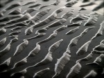
As I posted before, I am interested in the persistence of patterns across scales and even processes. For instance, this view (right) reminded me of blogger Silver Fox's recent post about the Basin and Range caterpillar army. An entirely different process: parallel morpholution.

If you look closely at the Google Map, above, you can see dim duneforms in the shallows, as a series of sub-parallel dark stripes. They echo the ripples in orientation and process, but have a wavelength of about 30 m. If you can't see them maybe this annotated version will help.

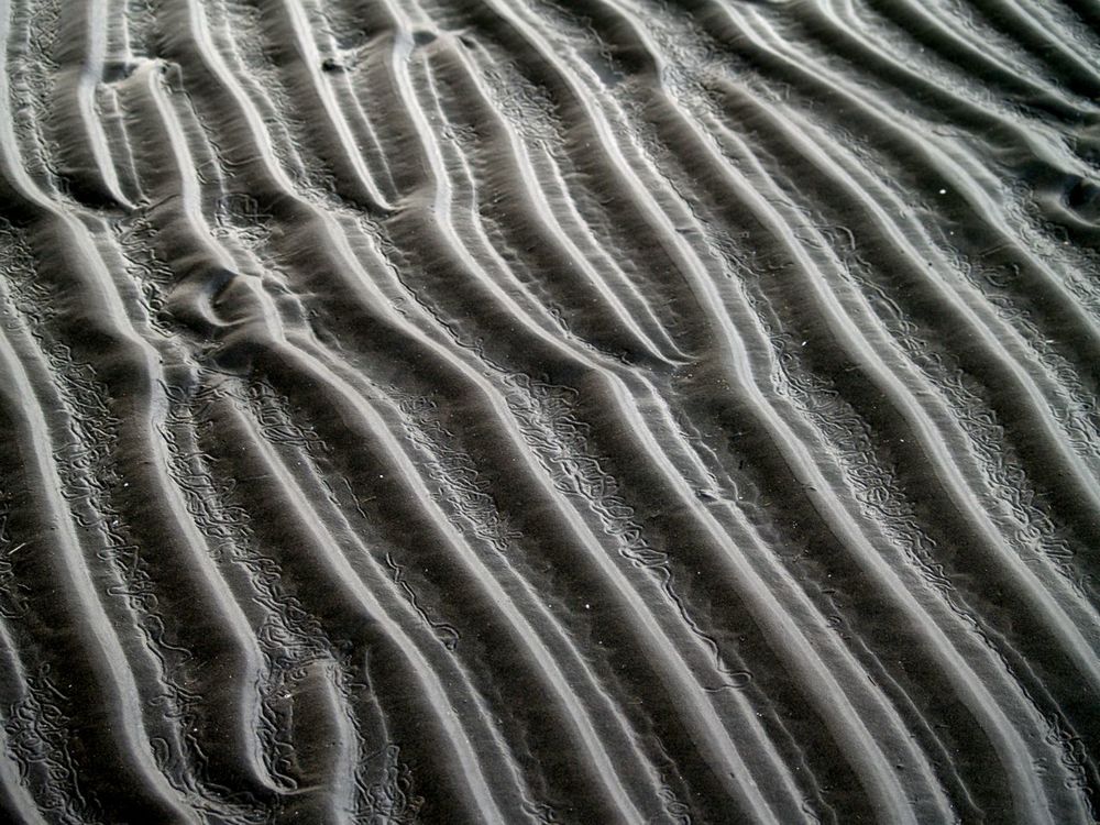
I would not claim to be an expert in the feeding traces of invertebrates, but I love taking pictures of them. I think the animals grazing in the cusps of these ripples were Chiridotea coeca, a tiny crustacean. You can read (a lot) more about them in Hauck et al (2008), Palaios 23, 336–343. According to these authors, such trails may be modern analogs of a rather common trace fossil called Nereites

Adding another author to Agile*

A pediatrician, a scuba diver, and a geophysicist walk into a bar . . .

Sounds like the start of a great joke, but actually, it will be the story of my first blog entry. The last time I had to describe my career to someone, it was in a completely different context. The week Matt moved to Nova Scotia, my wife and I were scrambling to get our scuba diving certification so we could dive the reefs of Mozambique. One of my best friends was getting married in South Africa and diving was one of the must-do activities on our trip.

Getting to the dive camp in the gentle beach settlement of Ponta Malongane was a mission. Crossing the border from the familiar and relatively cosmopolitan townships of South Africa into Mozambique was like shaking off the anaesthetic of an already waning familiarity. We watched entourage after entourage of vacationing South Africans in beach shorts creep their vehicles 25 metres beyond the mobile trailers and chain link fence that comprised an otherwise unrecognizable border post. Methodically, they would turn up the radio, as to celebrate their clearance into the country, take out the gauge and drop the tire pressure down to 0.8 bar.

A common conversation about driving to Mozambique starts like this...

“Evan, do you have a 4-by-4?”
“Yes.” We were lucky enough to borrow the groom's.
“How many spare tyres do you have?”
“Er, one, . . . just one”
“Oh, well, . . . you might be alright.”
Read More

Unsolved problems

One of the recurring dreams I've had this year is about unsolved problems. I've always loved these lists, the best known of which is perhaps the German David Hilbert's 1900 list of 23 unsolved problems in mathematics. There are several published versions of the list; take look at a later manuscript describing some of the problems.

A year or two ago, I read this meta-list in Wikipedia. Natch, I immediately wanted to create a list of unsolved problems in geoscience. It could help researches find big, interesting problems. It could help software developers focus their talents. It might just be a bit of fun. However, articles in Wikipedia need something to reference[citation needed], so even if I were capable of such a thing, one can't just sit down and hack one out. 

But you can try. Earlier this year, I drafted a proto-list for geophysics, drawn mostly from chats with friends. Please feel free to vote on the list, or add problems of your own. It is, I admit, a bit biased towards problems in seismology in pursuit of hydrocarbons. The list should be much broader, but I'm not yet the polymath I strive to be and quickly get out of my depth!

Here are the top five (per today) from my Google Moderator list of unsolved problems in geophysics:

  • How can we represent and quantify error and uncertainty from acquisition, through processing and interpretation, to analysis?
  • What useful signal or information can we extract from what we usually call 'noise' (multiples, refractions, reverberations, etc)?
  • How can we exploit the full spectrum in acquisition, processing, interpretation, and analysis?
  • Is there a 'best practice' for tying wells; if so, what is it?
  • What exactly is AVO-friendly processing?

What might a list of unsolved problems in geology look like? My likely-ignorant outlook suggests some:

  • Is it possible to predict the location, severity, and/or timing of earthquakes?
  • Do mantle plumes exist?
  • How do magnetic reversals happen?
  • Are mass extinctions cyclic?
  • Do the earth's physico-chemical systems mostly drive, or mostly respond to, changes in climate?
  • Does eustatic (global, synchronous, uniform) sea-level change happen, or does the ubiquity of local tectonism obviate the concept?
  • What exactly was the sequence of events that resulted in the end-Permian extinction? The end-Cretaceous?

I am proposing a workshop on the topic of unsolved problems in exploration and development geophysics at SEG next year in San Antonio. Ideas welcome.

Setting up shop

My family and I finally moved into our new old house on Sunday. We are slowly gaining the upper hand in the battle of the boxes. The kids have got some of their toys back and are finding their way around the place. I can find most things by looking in only about three cupboards. 

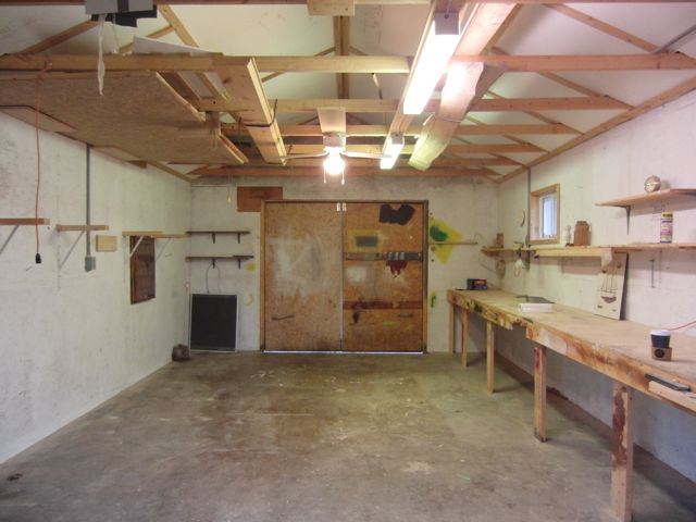
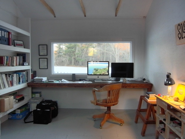
And my new office is almost finished. The last occupant of this place was a boat-builder, and he had a great workshop in the back yard (see pic). I would love to have kept it as-is, but a couple of days of trying to work in the house made it clear that I need a workspace outside the house. 

So I've partitioned off half the space, added a long landscape window, and a floor, and a built-in desk, and it should be comfortable enough to work in for a few months at least, maybe even years.

Even starting with some constraints, it was surprisingly hard to put my finger on exactly what would make my ideal workspace. Here are some of the things I decided I wanted, in no particular order:

  • Some sort of view
  • Natural light, ideally from a north-facing skylight
  • A long desk with no cable clutter
  • Plenty of space to tidy hard drives, printers, routers, etc.
  • Plenty of space for books and papers
  • Somewhere comfortable to sit and read
  • Somewhere to work on non-computery stuff (like another desk)
  • A wood-burning stove
  • A kitchenette and a toilet

The skylight, stove, and sanitation will have to wait, but I think I got most of the rest checked. I'll post a follow-up when it's nearing completion.


Resumé 2.0

Click for PDF

Click for PDF

Is your resumé boring?

When I was a confused postgraduate researcher (if there's any other kind), I applied for a job in marketing and product development. The company asked for a pitch, rather than a straight curriculum vitae. I made something up in Adobe's Illustrator drawing tool, with some product development ideas (shower gel you could shave with, IIRC), and got an interview. After that, I made slightly weird CVs for a few other jobs, including ones at the British Antarctic Survey and EnCana (see image, right). Nowadays I tend to think that if I can't get a job with a weird CV, then it's not the sort of job I want.

Recently I have started just giving people my LinkedIn profile, which contains most of the information you'd usually put on a resumé. 

I have also looked at VisualCV, an online resumé tool, but never actually taken the time to try it. I'm not convinced it lets you be as creative as you might want to be. 

If you need more inspiration, check out this list of efforts. Most of them are for what are sometimes called 'creative' jobs like graphic design, but I would argue that geology and geophysics are creative jobs too!

I don't know how much I really need a resumé any more, but I've enjoyed maintaining this geological timetable since 2005; click to download the PDF. [Click here for 2016 version, now with fewer typos!]

Update

on 2010-12-21 11:35 by Matt Hall

LinkedIn just added a resumé builder to their Labs... Click here to try it out. It seems to work quite nicely, though the output is quite conservative, and I've run into a couple of bugs. Worth a look.

Giftology and giftophysics

Geologists are not difficult to buy gifts for. In fact, you could do worse than just filling a shoe box with rocks from your garden. But if you want to, you can excite and inspire a geologist with some new kit, a nice map, or a piece of meteorite.

Geophysicists might be slightly trickier to please. A book on Fortran? A couple of ki's of dynamite? Best thing is to accidentally on purpose treat them like a geologist. After all, it's the thought that counts!

Compasses

Features to look for include clinometer, declination adjustment, and a sighting mirror. A bubble level and a scale bar are nice to have. Seasoned field geologists will already have a favourite, so steer clear unless you know what they need.

  1. Good — Silva Expedition 15TDCL, about $60
  2. Better — Suunto Tandem with declination adjustment, about $220
  3. Best — Brunton GEO Pocket Transit, about $820

Hand lenses

Features to look for include German manufacturer, metal housing, glass lenses, triple lens configuration, no chromatic aberration (this property is sometimes called achromatic), no spherical aberration (aplanatic). The 'gold standard', as it were, is the Bausch & Lomb Hastings Triplet, which usually sells for about $40 to $50 (for example, here). But there are others out there, like these:

  1. Good — BelOMO Triplet Loupe, about $35
  2. Better — Celestron LED illuminated loupe, about $40
  3. Best — Harald Schneider triplet loupe, about $280

Random stuff

You can't go wrong with any of these excellent gifts. 

For the geologist who has everything

These gifts speak for themselves. Joy guaranteed.

  1. Awesome — UGOBE PLEOrb robot dinosaur, about $470
  2. Awesomer — Andy Paiko glass seismograph, about $5000
  3. Awesomest — Triceratops horridus skull, about $70 000

Scale

One of the most persistent themes in geoscience is scale. Some properties of the earth are scale independent, or fractal; the shapes of rivers and coastlines, sediment grain shapes, and fracture size distributions might fall into this category. Other properties are scale dependent, such as statistical variance, seismic velocities (which are wavelength dependent), or stratigraphic stacking patterns.

Scale independent phenomena are common in nature, and in some human inventions. For example, Randall Munroe's brilliant comic today illustrating the solutions to tic-tac-toe (or noughts-and-crosses, as I'd call it). It's the optimal subset of the complete solution space, which shows its fractal nature completely.

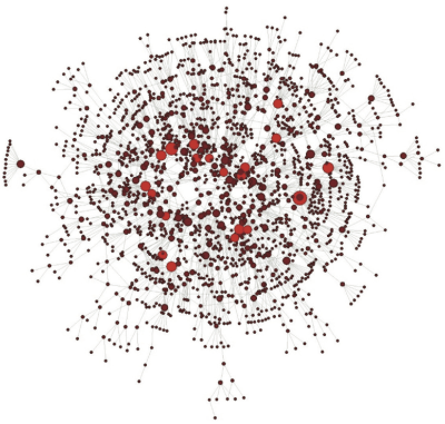
The network of co-authorship relationships in SEG's journal Geophysics is also scale-free (most connected authors shown in red). From my 2010 paper in The Leading Edge.

3 ways to be Agile*

Building on last week's post, I think that not only the principles of agile development could apply to subsurface science, I think some of the tactics employed might also benefit us geoscientists. For example:

Ship and iterate: get maps, sections, velocity models, even geomodels, made early. Don’t wait until everything is perfect (it never will be). Making these things will help reveal the weaknesses in the data and the uncertainties interpretation, and you can be more strategic about what you spend time on. Do everything you can to make the iteration faster (use macros, write scripts, outsource).

Daily scrums: subsurface teams get together on a daily basis, for no more than 10 or 15 minutes. Everyone gives their two or three headlines, quick things are dealt with, other things are flagged for follow-up. And everyone can get on with their day... no more 1 hour meetings!

Pair interpretation: seismic interpreters sit together to interpret, with one picking the lines and looking at waveform character, the other taking a wide-angle view, looking for consistency, nearby well ties, or thinking about the geological setting. Slower, probably, but maybe better (in programming, this technique produces fewer bugs).

Signs and symbols

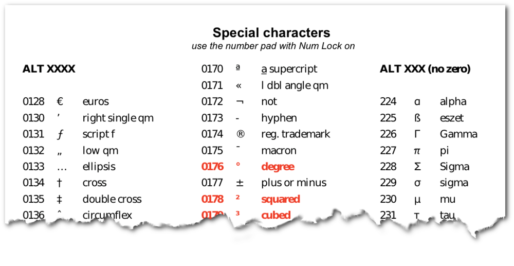
I made this sheet of signs and symbols when I was an explorationist at Statoil. I had always used Macs until then, and wrote my thesis in LaTeX; both make it very easy to write scientific signs and symbols. It seemed to be a struggle on the PCs we had at Statoil, so I made a cheatsheet of keyboard shortcuts for myself.

I sent it around to some people when I left ConocoPhillips and some said they liked it. So I thought I'd put it here for anyone to take. The idea is to print it out and put it on your wall. Next time you catch yourself writing 12 km2 or 25oC or not bothering with the pesky acute accent in resumé, just glance at the list. On Windows you would hold down the Alt key, then with NumLock on, type out the number indicated on the number pad (the numeric keys above the alphabet keys won't work).