News of the week

This week has been fairly quiet for geoscience and technology news, so we're hijacking our own post to highlight a couple of Agile* changes you might have missed. The first one is this very feature—our News of the week post. More or less every Friday we round up some geoscience news with an oil & gas or technology angle. If you spot something you think we should include, please scribble a quick note to hello at agilegeoscience dot com!

Another new feature on our site is subscription by email. Every blog post comes right to your email inbox, so you won't miss any Agile* goodness. Go to the SUBSCRIBE box on the right (under the tag cloud), enter your email address and hit Subscribe. It's that easy! No password to remember, 100% spam free, and you can unsubscribe any time. Powered by Google.

If you're a regular reader then you know all about our new mobile apps. At the moment, for completely practical reasons, they are only available for Android™ devices. We just upgraded our first app, Volume*, a prospect volumetrics tool—now you can save and recall prospects! In the next couple of days we will launch our first über-app, AVO*. Visit the wiki for a sneak peak.

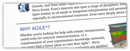
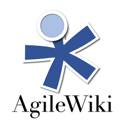
The wiki? Yes, last month we launched AgileWiki, an experiment in sharing knowledge about the subsurface. We know that much of what we know and do as industrial, applied scientists is proprietary—that's what in-house corporate wikis and knowledge bases are for. But some of it at least is basic, foundational, and generic in nature. And that's what AgileWiki is for. Join in, share what you know!

Agile's YouTube channelYou might have noticed we've started dabbling a bit with video, and have a nascent YouTube channel. Today, the focus is on our mobile apps, but we are planning features on seismic interpretation workflows and other fun things. And we're open to feedback and suggestions on this effort, please let us know what you think!

Agile Geoscience brochure imageWe work hard to be interesting and relevant, not self-promoting and commercial. But occasionally people ask us what we actually do. So we made a one-pager setting out our stall. If you need some help doing something weird and wonderful, or just tricky and time-consuming, keep us in mind! We love helping people.

This ends the public service announcement. Back to our regular news feature next week!

News of the week

As EAGE wraps up in Vienna, the spring geoscience convention season is now over for the big international petroleum geoscience societies (other recent conferences included AAPG, SPWLA, and Canada's GeoConvention).

Hammer, hand-lens, notebook, Twitter

A feature of this year's meetings has been the growth in Twitter as a news channel. The tweets are split about 50-50 between marketing broadcasts (mostly noise) and geoscientists' own highlights and thoughts (at least some signal). It would be splendid to see more people embrace Twitter as a way to share nuggets of information at big events. Give it a try: start an account and follow a few people. You'll get geoscience goodness from @allochthonous, @clasticdetritus, @rschott, and of course us, @kwinkunks and @EvanBianco.

Geophysics Rocks!

The International Association of Geophysical Contractors (@geophysicsrocks on Twitter) just launched an outreach website called Geophysics Rocks at the EAGE conference and trade show in Vienna this week. The new website was unveiled to thousands of attendees at the expo when more than 20 participating companies simultaneously played this two-minute video on their booth screens. Talk about a collaborative effort! After it was aired, the video URL was scanable via QR code at every booth that played it.

SEG builds e-Communities

The Society of Exploration Geophysicists (SEG) has rolled out an eCommunities page to add another dimension to their site. Members and visitors can now build and search online profiles to boost collaboration with other professionals. Is this just another late-to-the-party social network, with a new set of connections to link and maintain, or can it bring something new? It does have one thing going for it: it tugs at our primal urges for attribution and recognition among our peers. Stand out with outstanding content!

Rock Solid Images praised for rock physics atlas

Rock Solid Images (RSI) have compiled a 90-well Rock Physics & Seismic Response Atlas in support of a new licensing round in the Barents Sea. The report was announced in April and RSI has reported pre-orders of $600k ahead of its July release. The Atlas contains a catalog of forward modeled seismic responses with an emphasis on fluid substitution and saturation effects. The Atlas embodies a novel approach to setting standards of communication and knowledge across a basin. It will place RSI in a good position to sell advanced technologies to, and innovate for, their clients. Clever.

This regular news feature is for information only. We aren't connected with any of these organizations, and don't necessarily endorse their products or services.

News of the week

We've had a couple of weeks off in the newsroom, making way for the Canadian Geoconvention in Calgary last week. But this week we're back with geoscience and technology news that has caught our beady eyes recently.

Bids called for three oil blocks off Newfoundland

The Canada-Newfoundland and Labrador Offshore Petroleum Board (CNLOPB) called for nominations on three exploration parcels: one in the Gulf of St Lawrence, a second near the northern tip of Labrador, and a third in the Flemish Pass region north of the Jeanne d'Arc Basin. Producing projects in the latter area are delivering about 263 000 barrels per day. Interested parties have until 15 November to submit a bid.

Perceptive Pixel's 27" tablet

Perceptive Pixel has just announced a brand new 27-inch multi-touch desktop screen that could redefine the personal workstation and transform the way we work with computers. This new product isn't totally new technology, but it should be much more affordable and 'desktop ready' than their previous, highly customized, offerings. We can't wait to see seismic data on this thing! 

CEO Jeff Han originally introduced this technology at a TED conference in 2006. To read more about the technology and the company, which already lists Chevron among its clients, check out the press release

Open prestack seismic

The Open Seismic Repository, curated by dGB Earth Sciences, has just made available the prestack gathers for the Penobscot 3D seismic volume. This is especially exciting for Canadians: the Penobscot data are from Sable Island, Nova Scotia. This data set is over 100 GB and just might be the largest freely accessible seismic data on the web. It's an exciting addition to the collection, which already includes a small subset of gathers (below). We hope interpretations and reprocessings of these data get shared back into the community. Openness FTW!

In other news, dGB Earth Sciences and ARK CLS have launched an OpendTect connector plug-in for Schlumberger's Petrel, so that OpendTect's leading commercial plug-ins can accessed by the Petrel community. The plug-in is available in Schlumberger's OceanStore.

This regular news feature is for information only. We aren't connected with any of these organizations, and don't necessarily endorse their products or services. OpendTect is a mark of dGB Earth Sciences, and Petrel and Ocean are marks of Schlumberger.

The core of the conference

Andrew Couch of Statoil answering questions about his oil sands core, standing in front of a tiny fraction of the core collection at the ERCBToday at the CSPG CSEG CWLS convention was day 1 of the core conference. This (unique?) event is always well attended and much talked-about. The beautiful sunshine and industry-sponsored lunch today helped (thanks Weatherford!).

One reason for the good turn-out is the incredible core research facility here in Calgary. This is the core and cuttings storage warehouse and lab of the Energy Resources Conservation Board, Alberta's energy regulator. I haven't been to a huge number of core stores around the world, but this is easily the largest, cleanest, and most efficient one I have visited. The picture gives no real indication of the scale: there are over 1700 km of core here, and cuttings from about 80 000 km of drilling. If you're in Calgary and you've never been, find a way to visit. 

Ross Kukulski of the University of Calgary is one of Stephen Hubbard's current MSc students. Steve's students are consistently high performers, with excellent communication and drafting skills; you can usually spot their posters from a distance. Ross is no exception: his poster on the stratigraphic architecture of the Early Cretaceous Monach Formation of NW Alberta was a gem. Ross has integrated data from about 30 cores, 3300 (!) well logs, and outcrop around Grand Cache. While this is a fairly normal project for Alberta, I was impressed with the strong quantitative elements: his provenance assertions were backed up with Keegan Raines' zircon data, and channel width interpretation was underpinned by Bridge & Tye's empirical work (2000; AAPG Bulletin 84).

The point bar in Willapa Bay where Jesse did his coring. Image from Google Earth. Jesse Schoengut is a MSc student of Murray Gingras, part of the ichnology powerhouse at the University of Alberta. The work is an extension of Murray's long-lived project in Willapa Bay, Washington, USA. Not only had the team collected vibracore along a large point bar, but they had x-rayed these cores, collected seismic profiles across the tidal channel, and integrated everything into the regional dataset of more cores and profiles. The resulting three-dimensional earth model is helping solve problems in fields like the super-giant Athabasca bitumen field of northeast Alberta, where the McMurray Formation is widely interpreted to be a tidal estuary somewhat analogous to Willapa. 

Greg Hu of Tarcore presented his niche business of photographing bitumen core, and applying image processing techniques to complement and enhance traditional core descriptions and analysis. Greg explained that unrecovered core and incomplete sampling programs result in gaps and depth misalignment—a 9 m core barrel can have up to several metres of lost core which can make integrating core information with other subsurface information intractable. To help solve this problem, much of Tarcore's work is depth-correcting images. He uses electrical logs and FMI images to set local datums on centimetre-scale beds, mud clasts, and siderite nodules. Through color balancing, contrast stretching, and image analysis, shale volume (a key parameter in reservoir evaluation) can be computed from photographs. This approach is mostly independent of logs and offers much higher resolution.

It's awesome how petroleum geologists are sharing so openly at this core workshop, and it got us thinking: what would a similar arena look like for geophysics or petrophysics? Imagine wandering through a maze of 3D seismic volumes, where you can touch, feel, ask, and learn.

Don't miss our posts from day 1 of the convention, and from days 2 and 3.

Cracks, energy, and nanoseismic

Following on from our post on Monday, here are some presentations that caught our attention on days 2 and 3 at the CSPG CSEG CWLS convention this week in Calgary. 

On Tuesday, Eric von Lunen of Nexen chose one of the more compelling titles of the conference: What do engineers need from geophysicists in shale resource plays? Describing some of the company's work in the Horn River sub-basin, he emphasized the value of large, multi-faceted teams of subsurface scientists, including geochemists, geologists, geophysicists, petrophysicists, and geo-mechanics. One slightly controversial assertion: Nexen interprets less than 20% of the fractures as vertical, and up to 40% as horizontal. 

Jon Olson is Associate Professor at University of Texas at Austin, shared some numerical modeling and physical experiments that emphasized the relevance of subcritical crack indices for unconventional reservoir exploitation. He presented the results of a benchtop hydrofracking experiment on a cubic foot of gyprock. By tinting frac fluids with red dye, Jon is able to study the fracture patterns directly by slicing the block and taking photographs. It would be curious to perform micro-micro-seismic (is that nanoseismic?) experiments, to make a more complete small-scale analog.

Shawn Maxwell of Schlumberger is Mr Microseismic. We're used to thinking of the spectrum of a seismic trace; he showed the spectrum of a different kind of time series, the well-head pressure during a fracture stimulation. Not surprisingly, most of the energy in this spectrum is below 1 Hz. What's more, if you sum the energy recorded by a typical microseismic array, it amounts to only one millionth of the total energy pumped into the ground. The deficit is probably aseismic, at least certainly outside the seismic band (about 5 Hz to 200 Hz on most jobs). Where is the rest of the pumped energy? Some sinks are: friction losses in the pipe, friction losses in the reservoir, heat, etc.

Image of Horn River shale is licensed CC-BY-SA, from Qyd on Wikimedia Commons. 

Our next experiment: AgileWiki

We're excited to announce AgileWiki, a publicly editable encyclopedia of the subsurface, especially for the energy industry. You are unlikely to find how-to's on seismic interpretation in Wikipedia, or tutorials on basic concepts in Schlumberger's glossary, but this is exactly the sort of thing you'll find in AgileWiki.

If you're thinking: 'Great, but the last thing I need is another wiki...' then, fair enough, we sympathize. But here's why we think AgileWiki should have a role in your professional life:

  • It's only about the subsurface of the earth
  • It's only about the science and industry of energy
  • It's licensed CC-BY, which means you can re-purpose its content however you like, with due credit

We don't want to give the impression that AgileWiki is finished, or even very useful yet — it's very much early days and it has a long way to go. This is the Agile way: release early and update often. We think doing things like this in public is the best way to ensure it is relevant and useful. Evan and I are using the wiki already, so it is already growing organically.

A wiki is really just a website that anyone can edit (after you create an account; I have disabled anonymous edits). Please don't feel like you have to use it just as an encyclopedia. Here are some other ways to use AgileWiki:

  • As a way to share notes: next time you want to share something of general interest and email doesn't quite suit, feel free to document it in the wiki and simply send a URL.
  • As a personal and open notebook: You can store anything you want on your User page, which is automatically created when you create your account. 
  • As a source for non-proprietary content for an in-house or corporate wiki. Feel free to push generic content of your own back to us!

If you're not ready to jump into editing just yet but you'd like to see how this experiment can help you, why not try requesting an article? We're not promising to deliver overnight, but we want to help create content you want. So make a wish-list and let us know about it, on the wiki or in the comments below.

Last thing: please consider the ownership and possible confidentiality of whatever you want to share. By putting your material in the wiki, you agree to share it with others under the terms of its license.

News of the week

New site for seismic related work

There is a new job site for the seismic and geophysical industry called Seismic Works. Search for jobs, post jobs, advertise, or find crews, vendors, or equipment. Still very much in its early days, the site is nicely designed and very full-featured. You can also connect with SeismicWorks on Facebook. We look forward to seeing more sites and social connectors like this in our community.

SonicScope, a new real-time geophysical tool

Schlumberger has introduced a new logging-while-drilling tool called SonicScope that can be run directly behind the bit while drilling. The tool has potential to improve rock mechanics measurements and fracture identification by getting to the borehole wall immediately after penetration, minimizing the effects of washout and invasion. Real-time sonic measurements could enable pore pressure monitoring, time-to-depth information for seismic-well ties, and borehole damage assessment. We hope to see technology like this increase the relevance of rock physics. 

Geophysicist on last shuttle

Fellow geoscientist Andrew Feustel will be flying on space shuttle Endeavour's last trip into orbit. Andrew has an MSc in Geophysics from Purdue University in Indiana, USA, and a PhD in seismology from Queen's University in Ontario, Canada. He's even a fully paid-up member of the American Geophysical Union and the Society of Exploration Geophysicists. In addition to his scientific prowess, Andrew brings considerable mechanical tinkering skills, and will serve as the crew's repairman during the voyage. You can read more about him on his NASA profile page. Good luck, Andrew!

Nexen joins Marathon to explore shale gas in Poland

Canadian based Nexen Inc. will acquire a 40% working interest in ten of Marathon Oil's land agreements in Poland's Palaeozoic shale. Nexen brings experience in unconverntional drilling and completion technologies and shale gas experience from their assets in the Horn River shale in British Columbia, Canada. Europe's development of shale gas resources are complicated by population density, but activty in Poland's shale gas resources is evolving rapidly in the wake of successful shale plays in North America. Read more about the deal.

See all of our News of the week posts.

This regular news feature is for information only. We aren't connected with any of these organizations, and don't necessarily endorse their products or services. Image of Feustel is courtesy of NASA.

News of the week

Compared to last week, it's been a little quiet, and we've been a little busy (not working, don't worry). Here's a quick round-up of some things that have caught our eye over the last few days. 

Google takes on enterprise GIS

The biggest news from Google for a while: Google Earth Builder. For several years, the Google Earth virtual globe software has brought GIS-type workflows to everyone. It's been downloaded an incredible 700 million times. Now, for a fee, you can upload and manage your own geospatial data, and share custom layers with your organization... in a tool everyone knows already. This is potentially transformative because GIS, however powerful and popular, has yet to really penetrate any organization I've seen, though ESRI's amazing ArcGIS Explorer and ArcGIS Server offerings are gaining traction. It's typically still fairly niche, with a small community of power users, lots of dabblers, and masses of people who have no idea what it is and make maps by annotating JPEGs in PowerPoint. Yes, that is as scary as it sounds.

New geo-tagging camera add-on

Geo-tagging photos isn't new, even phones do it. But professional-grade GIS, with rapid location fixing, accurate altitude and compass functionality, is often quite expensive and/or bulky. A small US company, Eka Designs, has announced a couple of new products to try to change this: FotoSpot, an entry-level model, and FotoMapr, for professionals. These camera add-ons use WiFi, Bluetooth, or cable, to connect to a variety of regular digital cameras, oncluding models from Nikon, Canon, Panasonic, and Ricoh. You might want to upgrade your camera more often than your GPS, so this sort of peripheral might be a good investment if you spend a lot of time in the field. Certainly beats scratching down map coordinates and filenames in the rain. 

New books... a lot of new books

We took a look at Amazon's new geoscience books, and it turns out that books are nowhere near being dead! It's hard to find recent titles because when you sort by date you have to scroll past about 500 books that won't be published for months, years even. But here are some recent additions that caught our eye, in no particular order:

Book Titles: How The Bit After The Colon Is Getting Too Long: Where Will It End?

This regular news feature is for information only. We aren't connected with any of these organizations, and don't necessarily endorse their products or services. 

News of the week

The AAPG Annual Convention and Exhibition was this week in Houston. Several companies took the opportunity to announce news. Here's a quick round-up.

Real time well-site mineralogy

Fugro Robertson, a UK-based subsidiary of Dutch company Fugro, introduced RoqSCAN™, a new well-site tool for real-time mineralogical analysis of cuttings. It seems to be a field-portable version of the same technology as their well-received QEMSCAN® lab-based product. Both systems are based on scanning electron microscope analysis. Exciting to see more quantitative tools for geologists. 

More gear for 3D imaging

Ingrain, the exciting 'digital rock physics lab', have bought another Carl Zeiss microscope. But not just any microscope, the AURIGA Crossbeam FIB/SEM, or focused ion beam and scanning electron microscope. Ion beams are useful because, since ions are relatively massive, they can be used to shave extremely thin layers from a rock. The SEM can build up a 3D image of the rock, as it is progressively ablated in this way. If you have never seen Ingrain's 3D images, check out their website for papers like this one (1MB PDF). Amazing.

New plug-ins for viz tool

TerraSpark Geosciences, Geoff Dorn's spin-off from the University of Colorado at Boulder, make a nice-looking piece of software called Insight Earth®. Based on ARCO/BP-funded technology, it's an integrated seismic interpretation tool that seems to have some interesting functionality (we've never seen it in action though). The news is that the company has signed an agreement with visualization gurus INT to develop plug-ins for Insight Earth. Very cool, but we can't help thinking (dreaming?) as we look around these sites: Why isn't any of this open source? 

LMKR go announcement crazy!

The Dubai-based consulting and software firm pwned AAPG, at least if your yardstick is press releases or social media presence (follow @LMKRNews). They are clearly growing aggressively, having taken on marketing and support of Landmark's very nice GeoGraphix software last fall. Watch out for them! Here's what they had to offer:

  • They are hooking up with Object Reservoir, physicist and Landmark co-founder John Mouton's new company, to deliver new shale gas services 
  • They have acquired Cambridge Petroleum Software's Velocity Manager software, for depth conversion functionality.
  • They are adding Scrybe's weirdly-named Convofy to GeoGraphix. What does that mean? We think this may be the most momentous announcement of the year: they have added social media functionality to an integrated interpretation suite. The platform is fully mobile and supports, among other things, microblogging, document sharing, and commenting. 

Even if you are skeptical about social media, please staunch your inner cynic just for a moment and please watch this video. Think about where this last innovation could lead our notions of teamwork, especially in distributed teams. We are excited!

This regular news feature is for information only. We aren't connected with any of these organizations, and don't necessarily endorse their products or services. 

News of the week

AAPG conference starts on Sunday 

The community of petroleum geoscientists will convene in Houston in a few days for the AAPG 2011 Annual Convention & Exhibition. If any geo-tweeps will be there, spare a thought for those that aren't and update us on the events and happenings with the hashtag #ACE2011. Follow @AAPG_Events or @AAPG on Twitter. Wish we were there!

DownUnder Geosolutions coming up over

Australian based DownUnder GeoSolutions (aka DUG, at DuGeo.com) have recently announced that they will be opening offices in Calgary in May. One of the young entrepreneurs helping build this emerging technology company's was recently featured in Petroleum Exploration Society of Australia's magazine. One to keep an eye on!

CGGV have a new processing centre in Oman

The new CGG Veritas office will focus on onshore seismic acquisition and imaging services for the petroleum industry. The centre will also be hosting a university training facility in partnership with the national energy ministry and other industrial partners. In this regard, CCGV is hoping to help develop highly qualified Omani professionals.

Geoscientists without borders

The April issue of SEG's The Leading Edge features stories of the geoscience community solving global humanitarian problems. The International Symposium on the Application of Geophysics to Engineering and Environmental Problems (SAGEEP) has been formed to tackle everything from natural hazards and environmental awarness issues, to finding scarce freshwater resources in impoverished regions. Read more about how geoscientists are making a positive impact and empowering people through education and technology. Great to see this kind of out-reach.

This regular news feature is for information only. We aren't connected with any of these organizations, and don't necessarily endorse their products or services.