Smaller than they look

Suppose that you are standing on a pier at the edge of the Pacific Ocean. You have just created a new isotope of oxygen, 11O. Somehow, despite the fact that 12O is comically unstable and has a half-life of 580 yoctoseconds, 11O is stable. In your hand, you have a small glass of superlight water made with 11O, so that every molecule in the glass contains the new isotope.

You pour the water into the world's ocean and go home. In your will, you leave instructions to be handed down through generations of your family: wait several millennia for the world's ocean to mix completely. Then go to that pier, or any pier, and take a glass of water from the sea. Then count the 11O atoms in the glass.

What are the odds of getting one back?

Read More

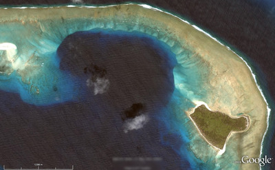
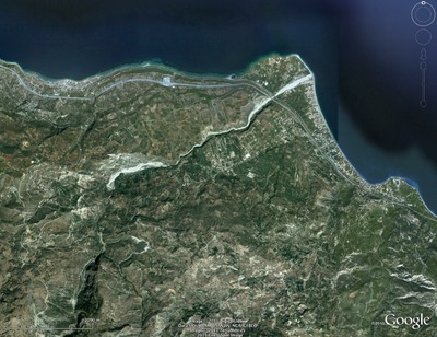
Where on (Google) Earth #272

I got WoGE #271 by the well-established lucky guess method. Some people mightn't think this is a method sensu stricto, but I will take what I can get. So I unabashedly declare victory and bring you number 272, fresh out of the oven; the time is 1600 AST, 2000 GMT.

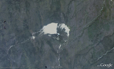
Where on (Google) Earth is the best way to get a repetitive strain injury since interpreting seismic data. If you are new to the game, it is easy to play. The winner is the first person to examine the picture below, find the location (name, link, or lat-long), and give a brief explanation of its geological interest. Please post your answer in the comments. And thanks to the Schott Rule, which I am invoking, newbies have a slight edge: previous winners must wait one earth hour for each previous win before playing.

So: where and what on Google's green earth is this?

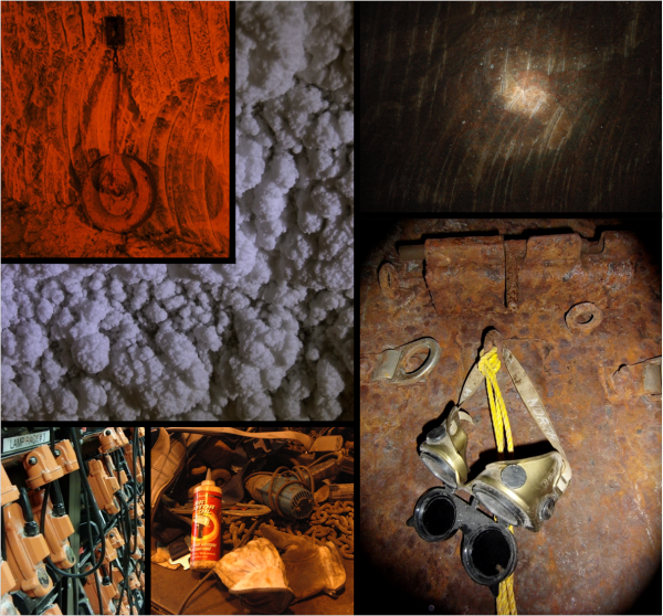
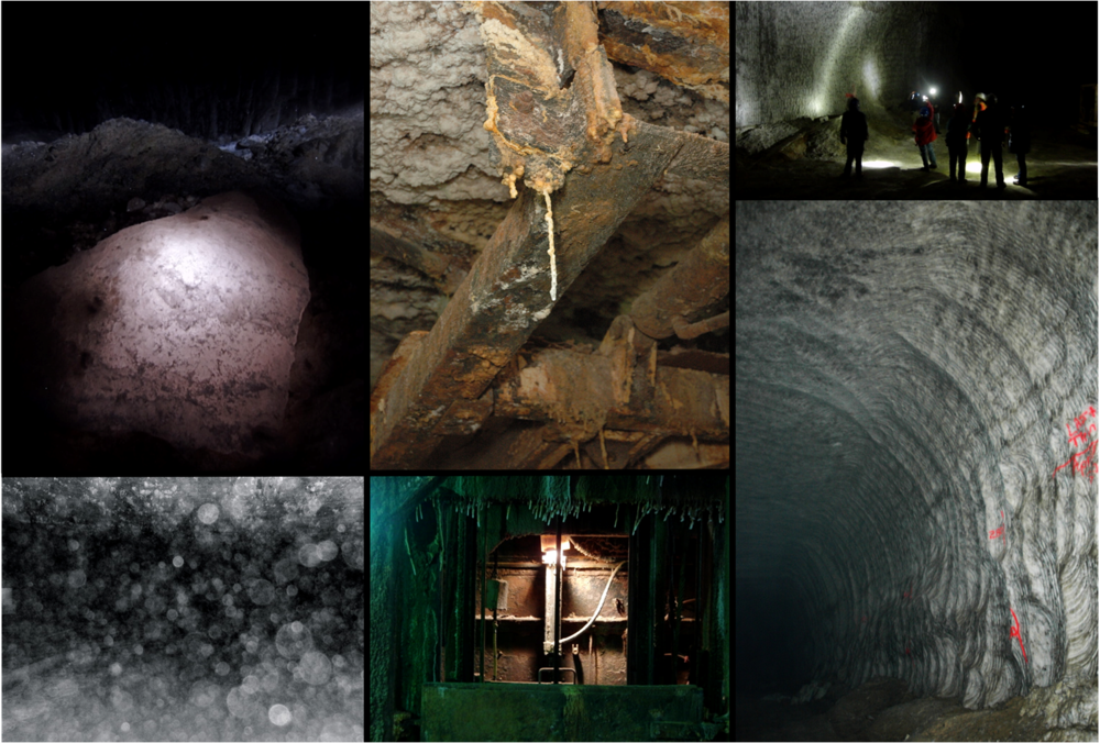
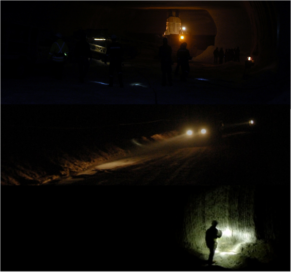
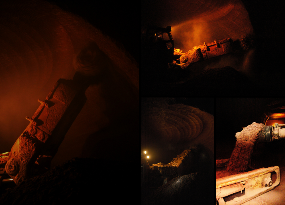
Potash mine photo tour

On Friday, Matt and I went on a tour of the PCS potash mine in Penobsquis, New Brunswick, as a precursor to the 2011 Atlantic Geoscience Society Colloquium in Fredericton.

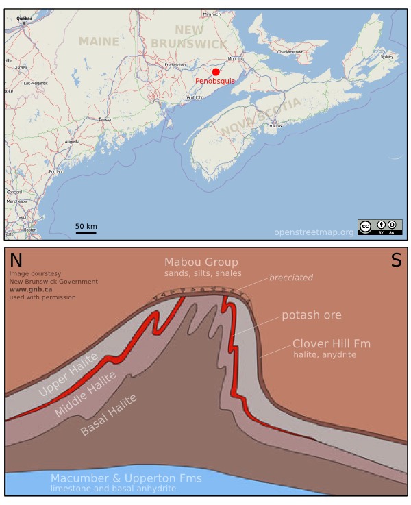
The evaporites of the Early Carboniferous Windsor Group were formed as a result of two marine incursions into an otherwise clastic red bed sequence within the Moncton sub-basin. The evaporites containing the potash ore have been folded into a NE-SW trending anticline as shown in the diagram below.

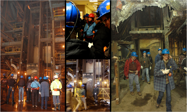
Brian Roulston hosted 24 visitors into the mine. We were lowered about 400 m down to the main workings then driven approximately 10 km underground to three main attractions: a cavern stope in the Basal Halite; an active stope in the halite; finally an active stope in the potash ore (sylvinite).

Thanks to Brian and his team at PCS for putting this tour together for us, it was so much fun.

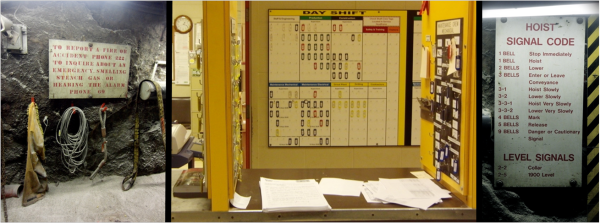
Signage

People

Gear

Salts, rusts, colors, and textures 

Darkness

Mining the ore

Where on Google Earth #266

Brian nailed Where on Google Earth #265. He doesn't have a blog of his own so he asked me to host it for him. So, over to Brian...

Much thanks go to Matt here for hosting this WoGE for me since I do not yet have a blog of my own. I'm already looking into options. This is just too much fun for a Google Earth addict like me.

Although this image is zoomed in pretty good I'll invoke the Schott Rule just to give newcomers like myself a chance. For those unaware, this means you must wait one hour for each previous WoGE win before you can post your answer. [Here are the previous winners in Ron Schott's KML file — Matt].

I've also hidden the orientation compass so you can safely assume North isn't necessarily at top. Can't make it too easy now, can we?

This one isn't just about the geology, but also the historical significance.

Please post responses in the comments. Posted at 0800 Atlantic, 1200 GMT.

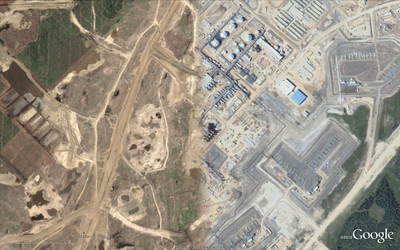
Where on Google Earth #265

After correctly but illegally identifying Ole's hellish Afar Triangle in WoGE #264 over at And The Water Seems Inviting, I hereby give you number 265 in this long-running geoscience quiz game started by Clastic Detritus

Where on Google Earth is the best use of a computer and some spare time since SETI@home. If you are new to the game, it is easy to play. The winner is the first person to examine the picture below, find the location (name, link, or lat-long), and give a brief explanation of its geological interest. Please post your answer in the comments below. And thanks to the Schott Rule, which I am invoking, newbies have a slight edge: previous winners must wait one hour for each previous win before playing.

So: where and what on Google earth is this? [Posted at 1303 GMT]

Where on Google Earth #259

I got WoGE #258 by the skin of my teeth, as I found the location but failed to fully identify the feature. I got the country rock right, but the igneous one wrong. As a soft rock chap, I consider this to be a technicality. Luckily, so did Metageologist Simon, the host. So I humbly accept my failings as a geoscientist and offer you the next instalment: number 259, and hereby post it at 1300 AST, 1700 GMT. 

Where on Google Earth is the best use of your lunch-break since Worms Reinforcements (the only computer game I ever wanted to play twice). If you are new to the game, it is easy to play. The winner is the first person to examine the picture below, find the location (name, link, or lat-long), and give a brief explanation of its geological interest. Please post your answer in the comments below. And thanks to the Schott Rule, which I am invoking, newbies have a slight edge: previous winners must wait one hour for each previous win before playing.

So: where and what on Google earth is this? (There are quite a few interesting things here, both geomorphologic and geologic; see how many you can get!)

What is a darcy?

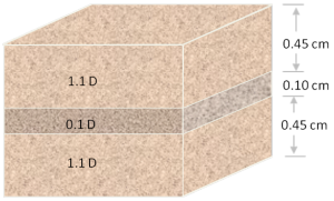
Permeability is the capacity of a porous material to transmit fluids. The SI unit of permeability is m2 (area) but the units adopted by the petroleum industry have been named after Henry Darcy, who derived Darcy's law. A darcy is a confusing jumble of units which combines a standardized set of laboratory experiments. By definition, a material of 1 darcy permits a flow of 1 cm3/s of a fluid with viscosity 1 cP (1 mPa.s) under a pressure gradient of 1 atm/cm across an area of 1 cm2.

Apart from having obscure units with an empirical origin, permeability can be an incredibly variable quantity. It can vary be as low as 10–9 D for tight gas reservoirs and shale, to 101 D for unconsolidated conventional reservoirs. Just as electrical resistivity, values are plotted on a logarithmic scale. Many factors such as rock type, pore size, shape and connectedness and can effect fluid transport over volume scales from millimetres to kilometres.

Okay then, with that said, what is the upscaled permeability of the cube of rock shown here? In other words, if you only had to find one number to describe the permeability of this sample, what would it be? I'll pause for a moment while you grab your calculator... Okay, got an answer? What is it?

Read More

The unlikelihood of improbable events

I picked a couple of old books off my shelf last night, to sit by the fire and read something on paper for a change. I chose two classics by Darrell Huff: How To Lie With Statistics (1975 edition), and How To Take A Chance (1965 edition). They are both excellent, and the former is even still in print. The amusing story shown here (right) faces the first page.

I was a bit surprised this morning when the first thing I see, via Twitter, is this story from Reuters: wounded fox shoots its would-be (and unnamed) killer in Belarus (of all places). I thought this was quite a coincidence.

What are the chances of this being a true story, and not some sort of mistake, or hoax, or piece of folklore? At first, I thought of Bayes' theorem:

P(A|B) = \frac{P(B | A)\, P(A)}{P(B)}.

With this equation, we can calculate the probability of the story being true, given the chances of such a thing happening in the first place (slim), and the reliability of the media (pretty high). If you think the chances of a man being shot by a fox are 1 in 1000, say, and the reliability of the media is 99%, then Bayes' theroem suggests that the probability of this story being true is just 9%.

Nine percent seemed pretty low to me. Maybe I was being too hard on the media, I thought.

But then another thing I just saw yesterday was that Google News now searches archives going back over 100 years. Amazing. So I searched for fox shoots hunter, and hit Archive. And sure enough, it turns out this sort of thing happens all the time.

Shown here (left), the Wilmington Morning Star, 21 January 1981: A fox shot and killed (!) an unnamed hunter in central Yugoslavia after hitting the animal with his rifle butt. 

Another story, from the Modesto Bee of 16 November 1948, details another nasty fox-shoots-man-after-man-tries-to-wallop-injured-fox-with-rifle incident.

So, I don't know if this story is true or not, but personally I doubt it. Looking at how it has spread like rabies through the media though, I think it's fascinating how these tales become part of our experience. No-one knows where it started, and a bit of digging suggests it may even be doubtful.

How many stories like that are there in the organization where you work? And how will you question the next one you hear?
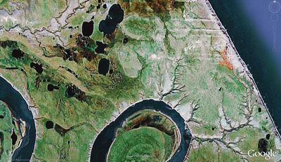
Where on Google Earth #252

Felix Bossert stumped us with one of the most unusual geomorphologies on the planet with WoGE #251 last week. The  sub-parallel elongate low-sinuosity (OK, wormy) features, reminiscent of a fingerprint, turned out to be the acidic dregs of a salt lake in Western Australia. 

Where on Google Earth, the brilliant brainchild of clasticdetritus, is the best use of satellite imagery since looking at homes and gardens of the rich and famous. If you are new to the game, it is easy to play. The winner is the first person to examine the picture below, find the location (name, link, or lat-long), and give a brief explanation of its geological interest. Please post your answer in the comments. Thanks to the Schott Rule, which I hereby invoke, newbies have a slight edge: previous winners must wait one hour for each previous win before playing.

Where and what on Google's blue earth is this?

Tell more about me

I thought a neat way to highlight my experience and career interests would be to make up a word cloud from the text in my resume. It's a map of the significant words describing my professional life. Try it out on yourself, and who knows, you might learn to look at yourself in a whole new way :)

When I look at this map, I wish a few words were bigger: business, value-adding, variety. However, I think they are growing!  Developed, is past tense.  I wish to continue to develop and innovate more and technologies and resources.  Problem-Solving; I feel like that is under-represented. Seismic and scholarship seem to be disporportionately large, but I guess I will have to grow other words to catch up with them. This word cloud has omitted places where I have done geoscience; Offshore Australia, Central Alberta, Athabasca Oil Sands, Finland, North SeaAtlantic Canada.  Words missing altogether; enthusiastic, creative, resourceful, a little geeky?