News of the week

A quick round up of geosciencey tech news at the end of a busy week at SEG.

Mmm, open source

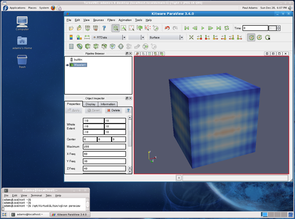
Visualization company Kitware, makers of open source viz software Paraview, have released a new version of VTK, their toolkit for developers. Version 5.8 has new and improved Python wrappers and support for openGL inside documents. They are also offering free online courses for much of their technology. If you don't know their stuff, now's the time to check it out!

Real-time data toolbox

Twitter and geophysics? Maybe: they announced some open source goodness this week with their Storm library for real-time analysis of massive data streams. They developed it for analysing breaking news and global events, but we think it might have application in all kinds of real-time data processing problems like microseismic and production monitoring. Find the project on GitHub.

Not just another software company?

Dynamic Graphics, a small California company, caught our eye. Their low profile seems about to change, as their 'quantitative visualization' software looks ready to compete with anyone. Their focus on 4D and well-planning pits them against outfits like Transform Software, Down Under GeoSolutions, and of course all the usual suspects.

Learn Python!

Enthought are the leaders in scientific programming and especially support for Python, as well as on-demand development. They now offer a regular Python programming course just for geophysicists, and tour all over the world with it. The next edition is in Houston, 2–4 November. If you ever wanted to dabble with code, this is your chance: Python is easy to learn and very powerful.

This regular news feature is for information only. We aren't connected with any of these organizations, and don't necessarily endorse their products or services. Python is a trademark of the Python Software Foundation. ParaView and VTK are trademarks of Kitware. Storm is a trademark of Twitter, Inc.

Follow the SEG conference

The eighty-first annual meeting of the Society of Exploration Geophysicists (SEG) will be held in San Antonio next week. The technical session will hold over 600 oral poster presentations, and the exposition hall will be hosted by more than 350 companies, government agencies, research and educational institutions. More than 8000 people from 85 countries will attend.

Whether you are roaming on-site, or stuck in your office, find out what people are saying, what's happening, and get involved in the conversation. You can follow live updates throughout the week by coming back to this post or searching for the hashtag #SEG11 using Twitter's search.


If you are going to the conference, consider sharing your ideas and engaging with this community. Or tell us what you think by leaving a comment.

Click here for all the posts about SEG 2011

News of the week

Dips from pics

Algeria foldsIn collaboration with the Geological Survey of Canada, Pangaea Software have built a very nifty tool, Orion, for computing dip from satellite images and digital elevation models. With these two pieces of data, and some assumptions about scale, it's possible to deduce the dip of strata without getting your boots muddy. Matt heard all about this tool from the GSC collaborator, Paul Budkewitsch, at the 3P Arctic conference in Halifax last week; here's their abstract

CGGV Trilobit nodeOcean bottom investment

CGGVeritas has made a commitment to manufacture 800 new Trilobit four-component deepwater nodes for seismic acquisition, to add to its existing pool. The device has three oriented accelerometers plus a hydrophone in addition to an onboard battery and recording system. This all-in-one design can be deployed on the seabed by most ROVs, making it easy to place near platforms and other infrastructure that towed streamer and cable systems cannot access. 

Arguably the industry leader in cableless systems is FairfieldNodal, who are already deploying more than a thousand nodes. It's great to see a big player like CGGVeritas coming to compete with this potentially transformative technology.

Update for Insight Earth

Colorado-based software company TerraSpark has just announced the release of Insight Earth 1.6, an integrated volume interpretation tool. Enhancements include a more interactive data import and export interface, improved velocity modeling, and upgrades to the automated fault extraction. In a January post, Evan highlighted an article by Stan Hammon of TerraSpark on the computational and psychological factors affecting intellegent design. It's inspired stuff.

Re-introducing SubSurfWiki

AgileWiki is now SubSurfWiki, at subsurfwiki.org. Please change your bookmarks! We felt that it was a little too Agile-centric and want to appear as open web-space for anything subsurface. We want it to grow, deepen and diversify, and above all be useful. So check it out and let us know if you have any feedback on utility, appearance and content.

More news... If you like this, check out previous news posts from Agile*

Orion is a trademark of Pangaea Software. Insight Earth is a trademark of TerraSpark. SubSurfWiki is a trademark of Agile Geoscience. The satellite image is copyright of Google. This regular news feature is for information only. We aren't connected with any of these organizations, and don't necessarily endorse their products or services.

What we did over the summer holidays

The half-life of a link is hilariously brief, so here is an attempt to bring some new life back into the depleted viewership of our summer-time blogging. Keep in mind that you can search for any of the articles on our blog using the search tool, shown here, or sign up for email updates lower down on the side bar, for hands-free, automated Agile goodness every time we post something new.  

Well worth showing off, 4 July: This post was a demonstration of the presentation tool Prezi applied to pseudo-digital geoscience data. Geoscience is inherently visual and scale dependant, so we strive to work and communicate in a helicoptery way. I used Prezi to navigate a poster presentation on sharing geo-knowledge beyond the experts

Geophysical stamps—Geophone, 15 July: Instalment 3 of Matt's vintage German postage stamps was a tribute to the geophone. This post prompted a few readers to interject with suggestions and technical corrections. We strive for an interactive, dynamic and malleable blog, and their comments certainly improved the post. It was a reminder to be ready to react when you realize someone is actually reading your stuff. 

Petrophysics cheatsheet, 25 July and its companion post: Born out a desire to make a general quick reference for well logs, we published the Petrophysics cheatsheet, the fourth in our series of cheatsheets. In this companion post, you can read why petrophysics is hard. It sits in a middle ground between drilling operations, geoscience, and reservoir engineering, and ironically petrophysical measurements seldom measure the properties we are actually interested in. Wireline data is riddled with many service providers and tool options, data formats, as well as historical and exhaustive naming conventions.

How to cheat at spot the difference, 3 Aug: Edward Tufte says, "to clarify, add detail". Get all your data into one view to assist your audience in making a comparison. In this two-part post Matt demonstrated the power of visual crossplotting using two examples: a satelite photo of a pyroclastic flow, and a subsurface horizon with seismic attributes overlain. Directly mapping partially varying properties is better than data abstractions (graphs, tables, numbers, etc). Richer images convey more information and he showed us how to cheat at spot the difference using simple image processing techniques.

Digital rocks and accountability, 10 Aug: At the First International Workshop in Rock Physics, I blogged about two exciting talks on the first day of the conference on the promise of digital rock physics and how applied scientists should strive to be better in their work. Atul Gawande's ternary space of complexity could serve as tool for mapping out geoscience investigations. Try it out on your next problem and ask your teammates to expose the problem as they see it.

Wherefore art thou, Expert?, 24 Aug: Stemming from a LinkedIn debate on the role of service companies in educating and empowering their customers, Matt reflected on the role of the bewildered generalist in today's upstream industry. Information systems have changed, perfection is a myth and domain expertise runs too deep. Generalists can stop worrying about not knowing enough, specialists can builder shallower and more accesible tools, and service companies can serve instead of sell. 

Pseudogeophysics, 31 Aug: Delusion, skeptisicm, and how to crack a nut. This post drew comments about copyright control and the cost of lost opportunity; make sure to read the comments section of this post.

So yeah, now go catch up on your reading. 

News of the week

The summer is, unbelievably, drawing in. While you've been gadding about in the sunshine, we've been scouring the geoscience and technology news — just for you! Here are some things that caught our eye in August. 

Spectral stuff from ffA

If you're a regular reader, you know we'll always cover a story about seismic frequency and resolution. A week ago, purveyors of high-tech seismic attributes ffA introduced HD Frequency Decomposition, or HDFD. As you might guess, HD stands for high definition, though it's not clear what that means in the context of seismic attributes. As is fairly normal with resolution-enhancing technology, the claims are eyebrow-raisingly bold:

...[we can] step beyond the resolution limitations of conventional frequency decomposition techniques.
Steve Purves, Technical Director, ffA

You can read about the technique in the nicely illustrated datasheet, but don't expect to find out how it works. I was disappointed to see that it doesn't even mention the type of decomposition; we assume it's some sort of scale-based approach (that is based on a wavelet, not Fourier, transform). Quiz them yourself at SEG next month in Booth C-1644.

By the way, if you're going to SEG and have a smart phone, think about keeping up with the buzz by following some chatterboxes on Twitter—@SEGAnnualMtg, @ParadigmLtd, @ESG_Solutions, @kwinkunks, and @EvanBianco. You can create and account and just follow the conversation, but it's more fun to join in!

More microseismic power for Canada

A good friend of Agile's recently went to work at Spectraseis, a seismic processing firm specializing in microseismic and reservoir monitoring in general. They just opened a Calgary office, so good luck to them in what is a pretty tight market (there must be 50 seismic processing shops in Calgary). The company also announced $3.6M of investment from Credit Suisse, so they are clearly on a roll.

Next gen knowledge management

Bayes' Theorem in neonRepsol, the Spanish oil company and supercomputing powerhouse, is rolling out some new knowledge sharing technology from Autonomy, a fast-growing UK company. There are two pieces: IDOL, an enterprise search engine, and Virage, a rich media management system. 

Autonomy is an awesome company. How do we know this? They have Bayes' Theorem up in neon lights. Yeah, Bayes' Theorem. 

Get geo-referenced maps faster

Elsevier is one of the giants of 'old school' publishing, but also one of the more innovative ones (have you seen their graphical abstracts?). They have just introduced an awesome-looking search site for exploration geoscientists, called Geofacets. It's a set of power tools for finding maps and figures, already georeferenced and ready for a GIS. It even includes IHS's global basins map to search more geologically, and includes what you need to know about rights and permissions. If your company has ScienceDirect access, which they probably do, then you should have immediate access.

Previous news posts from Agile*

HD Frequency Decomposition is a trademark of ffA, IDOL and Virage are trademarks of Autonomy, Geofacets is a trademark of Elesevier. Bayes' Theorem image is CC-BY-SA licensed by its creator mattbuck. This regular news feature is for information only. We aren't connected with any of these organizations, and don't necessarily endorse their products or services.

First-of-its-kind workshop

Next week I am going to the Colorado School of Mines to attend the First International Workshop on Rock Physics, 1IWRP. The name certainly is a bit curious: surely there must have been conferences in rock physics in the past, right? Yes, but the title points to the notion that this conference is the first time a meeting of petroleum rock physicists has happened independently of a technical society such as the EAGE or SEG. I don't see this as a specialist community revolting against these organizations, but it reflects an increase in attention and enthusiasm for the application of rock physics in the industry. Interestingly, this conference sprang directly from a discussion group on LinkedIn.

I will be presenting a poster entitled, Create a software culture beyond the experts, as part of the sesssion devoted to Transferring rock physics knowledge and technology to asset teams. It's a topic well-suited to this audience, because, even though rock physics is a key component in many areas of petroleum geoscience, it still remains partially obscure, or under-recognized as a take-it-or-leave-it niche. Mine will be a softer, community-building appeal for knowledge sharing beyond our distinguished specialists.

The technical agenda has been posted to the conference website. The conference has received solid corporate sponsorship; more than $40k according to the announcements. With 58 technical talks and 25 poster presentations over four days, plus two field trips, it is shaping up to be an intense week. A few talks that I am particularly interested in are:

  • Frequency-dependent amplitude-versus-offset analysis, Mark Chapman
  • Velocity Evolution during Controlled CaCO3 Precipitation and Dissolution, Ralf Weger, et al.
  • Anisotropic static and dynamic moduli from a pair of shale plugs cut parallel and perpendicular to bedding, Douglas Miller & Richard Plumb
  • Anisotropic permeability in fractured reservoirs from frequency-dependent seismic AVAZ data, Aamir Ali & Morten Jakobsen
  • Use of sonic and seismic anisotropy to characterize resource shales, Colin Sayers

If anything in the conference catches your eye, drop me a line in the comments and I will do my best to capture notes on it. I will be reporting highlights throughout the week on the blog, so please be sure to check back and follow along. 

The photograph of the Colorado School of Mines campus is the work of Wikipedia user Cperko.

News of the week

We hope you're having a great summer. Our website has been quieter than usual this week, but we're busy building things—stay tuned. And we haven't done a news post for a few weeks, so here are some things that have caught our eye.

A new imaging paradigm

Lytro has begun what may be a revolution for photography with the light field camera, putting the choice of the focal point and depth of field in the hands of the viewer, not the photographer. Try it yourself: click on these examples to change the focal point of the images.

The radical new sensor works by not only capturing the intensity of light, but also its direction. This means the full visual field can be reconstructed. You can view the inspiring gallery of dynamic images or read more about the methods behind computational photography from Ian Hopkinson's blog post. The analogy to full wavefield imaging is obvious, but perhaps the most exciting story is not the technology, but the shift of control from imager (processor) to viewer (interpreter). 

Don't compress the data, expand the medium

Wolfram, makers of Mathematica among other things, are a deeply innovative bunch. This week they launched the Computable Document Format, or CDF, for interactive documents. These new documents could make reports, presentations, e-textbooks, and journal articles much more interesting. 

INT releases Geo Toolkit 4.2

Interactive Network Technologies, makers of the INTViewer interpretation software, have released a new version of its GeoToolkit, version 4.2. It's a proprietary C++ library for developers of geoscience software, and is used by many of the major exploration companies. New features include

  • Improved Seismic display with support for anti-aliasing, transparency, and image rotation
  • New indexed seismic data support for rapid access of large datasets
  • Enhancements to Chart libraries, including multiple selection within charts and ability to link charts.

TimeScale Creator gets a major upgrade

We have written before about this handy application from a Purdue consortium; it should be in every geoscientist's toolbox. Keep an eye out over the summer and fall for new datapacks (including Arctic Canada, Australia, NE Russia), and an all-new web version. Version 5 has some great enhancements:

  • A new data input format, and some limits on user data in the free version
  • Database and display improvements for humanoids, dinocycsts, and passive margins, plus new datapacks
  • Improved geographic interface, now with index maps

This regular news feature is for information only. We aren't connected with any of these organizations, and don't necessarily endorse their products or services.

News of the week

Happy Canada Day! Here is the news.

Scotian basin revivial?

Geologist–reporter Susan Eaton has a nice piece in the AAPG Explorer this month, explaining why some operators still see promise in the Scotian Basin, on Canada's Atlantic margin. The recent play fairway analysis mentioned in the report, however, is long overdue and still not forthcoming. When it is, we hope the CNSOPB and government promoters fully embrace openess and get more data into the public domain.

Yet another social network!

In the wake of LinkedIn's IPO, in which the first day of trading was over 500 times its net earnings in 2010, many other social networks are starting to pop up. Last month we mentioned SEG's new Communities. Finding Petroleum is a new social network, supported by the publishers of the Digital Energy Journal, aimed at oil and gas professionals. These sites are an anti-trust anomaly, since they almost have to be monopolies to succeed, and with so much momemtum carried by LinkedIn and Facebook, new entrants will struggle for attention. Most of the Commmunities in SEG seem to be essentially committee-based and closed, and LinkedIn micro-networks are getting chaotic, so maybe there's a gap here. Our guess is that there isn't.

The oil & gas blogosphere

Companies are increasingly turning to blogging and social media tools to expand their reach and promote their pursuits. Here are a couple of industry blogs that have caught our eye recently. If you are looking to read more about what's happening in subsurface oil and gas technology, these blogs are a good place to start.

If you use a microblogging service like Yammer, you may not know that you can also follow Twitter feeds. For example, here's a Twitter list of various companies in oil & gas.

Job security in geoscience

Historically, the oil and gas industry follows hot and cold (or, if you prefer, boom and bust) cycles, but the US Bureau of Labor Statistics predicts geoscience jobs will be increasingly in demand. A recent article from The Street reports on these statistics suggesting that the earth science sector is shaping up to be genuinely recession proof. If there is such a thing.

Agile* apps update

We're happy to report that all of Agile's apps have been updated in the last week, and we have a brand new app in the Android Market! The newest app, called Tune*, is a simple calculator for wedge modeling and estimating the amplitude tuning response of thin-beds, as shown here.

In our other apps, the biggest new feature is the ability to save cases or scenarios to a database on the device, so you can pull them up later.

Read more on our Apps page.

This regular news feature is for information only. Apart from Agile*, obviously, we aren't connected with any of these organizations, and don't necessarily endorse their products or services.

News of the week

CCGVeritas moves towards a million channels

DSU1 receiverSercel, a subsidiary of CGGVeritas, has introduced new data transmission technology, Giga Transverse, an add-on to the 428XL land acquisition system. The technology increases the maximum channels per line from 10 000 to 100 000, and brings them a big step closer to the possiblity of one million channels on a single job. It will immediately benefit their UltraSeis offering for high-density point-receiver land acquisition. They also refreshed the DSU1 receiver (left), making it smaller and sharper. Young geophysicists must be salivating over the data they will be processing and interpreting in the decades to come.

Petrophysics coming to OpendTect

dGB has a built a comprehensive software suite for the seismic world, but OpendTect is a little light on petrophysics and log analysis. Not anymore! There's a new plugin coming to OpendTect, from Argentinian company Geoinfo: CLAS, or Computer Log Analysis Software. This will make the software attractive to a wider spread of the subsurface spectrum. dGB are on a clear path to creating a full-featured, deeply integrated platform. And OpendTect is open source, so petrophysicists may enjoy creating their own programs and plugins for working with well log data.

Petrel 2011 incorporates knowledge sharing

In Petrel, Schlumberger is introducing a multi-faceted knowledge environment for the entire spectrum of subsurface specialists. The announced improvements for the 2011 version include coordinate conversion for seismic data, better seismic flattening, more interpretation functions, and, most interesting of all, introduces the Studio™ environment. Geoscientists and engineers can search and browse projects, select data, and customize their screens by creating personal collections of often-used processes. It doesn't sound as interactive or social as the awaited Convofy for GeoGraphix, but it is good to see software companies thinking about large-scale, long-term knowledge issues, and it already exists!

Open source vizualization virtualization

High-end visualizaiton performance on a laptop... perhaps even a tablet! TurboVNC in action in the US government. Image: US Data Analysis & Assessment Center wiki.Australian E&P company Santos Ltd recently won the 2011 Red Hat Innovator of the Year award. From the award submission: "Santos has been burnt in the past by hanging its hat on proprietary solutions only to have them rendered uneconomical through being acquired by bigger fish. So for Santos, the move to open source—and to Red Hat—also proved to be a security blanket, as they could be assured that no one could walk in and take its solution away".  Borne out of an explosion of geo-computing costs, and their desire to push the limits of technology, the company sponsored the TurboVNC and VirtualGL projects. The result: users can interpret from anywhere using a standard issue laptop (with dual 24" monitors when at their desks), achieving better performance than traditional workstations. Great foresight! What are you doing about your geo-computing problems?

This regular news feature is for information only. We aren't connected with any of these organizations, and don't necessarily endorse their products or services. Petrel and Studio are trademarks of Schlumberger. Giga Transverse is a trademark of Sercel. Low res DSU1 image from Sercel marketing material.

News of the week

A geoscience and technology news round-up. If you spot anything we can highlight next week, drop us a line!

Using meteorite impacts as seismic sources on Mars

On Earth and Mars alike, when earthquakes (or Marsquakes) occur, they send energy into the planet's interior that can be used for tomographic imaging. Because the positions of these natural events is never known directly, several recording stations are required to locate these data by triangulation. The earth has an amazing array of stations but not Mars. 

Nick Teanby and James Wookey, geophysicists at the University of Bristol, UK (@UOBEarthScience on Twitter), invvestigated whether meteorite impacts on Mars provide a potentially valuable seismic signal for seeing into the interior of the planet. Because new craters can be resolved precisely from orbital photographs, accurate source positions can be determined without triangulation, and thus used in imaging. 

Investigation showed that seismicity induced by most meteorites is detectable, but only at short ranges, and good for investigating the near surface. Only the largest impacts, which only happen about once every ten years, are strong enough for deep imaging. Read more in their Physics of the Earth and Planetary Interiors paper here. Image credit: NASA/JPL.

Geomage acquires Petro Trace 

Seismic processing company, Geomage, has joined forces with Petro Trace Services in a move to become a full-workflow seismic processing service shop. The merging of these two companies will likely make them the largest geophysical service provider in Russia. Geomage has a proprietary processing technology called Multifocusing, and uses Paradigm's software for processing and interpretation. Click here to read more about the deal.

New bathymetric data for Google Earth

Google Earth now contains bathymetric data from more than two decades of seafloor scanning expeditions. The update was released on World Oceans Day, and represents 500 different surveys covering the size of North America. This new update will allow you to plan your next virtual underwater adventure or add more flair to your envrionmental impact assessment. Google Earth might have to seriously reconsider adapting their streetview name to what,... fishview? Wired.com has a nice demo to get you started. Image: Google Earth.

Workshop: open source software in geophysics

The AAPG's Petroleum Technology Transfer Council, PTTC, is having a workshop on open source software next week. The two-day workshop is on open software tools and reproducibility in geophysics, and will take place at the Houston Research Center in west Houston. Matt will be attending, and is talking about mobile tools on the Friday afternoon. There are still places, and you can register on the University of Texas at Austin website; the price is only $300, or $25 for students. The organizer is Karl Schleicher of UT and BEG.

This regular news feature is for information only. We aren't connected with any of these organizations, and don't necessarily endorse their products or services. Image of Mars credit: NASA/JPL-caltech/University of Arizona. Image of Earth: Google, TerraMetrics, DigitalGlobe, IBCAO.